By creating this site, my intention is to acquaint you more closely with the Croatia, its history, famous persons, cities, cuisine, natural beauty and other things. Every few days I will publish posts with these topics: nature, cities, sports and famous persons. If you have any comments or wishes, please type in the chatbox. Enjoy your reading!
Prikazani su postovi s oznakom Nature. Prikaži sve postove

srijeda, 30. ožujka 2011.

Brač Island


Supetar harbour

Brač is an island in the Adriatic Sea within Croatia, with an area of 396 km², making it the largest island in Dalmatia, and the third largest in the Adriatic. Its tallest peak, Vidova Gora, or Mount St. Vid, stands at 778 m, making it the highest island point in the Adriatic. The island has a population of 13,000, living in numerous little towns, ranging from the main town Supetar, with more than 3,500 inhabitants, to Novo Selo, where only a dozen people live. Bol Airport on Brač is the largest airport of all islands surrounding Split.

History
Archaeological findings date the existence of human communities on the island back to the palaeolithic (in the Kopačina cave between Supetar and Donji Humac). Nevertheless, there are no traces of human habitation from the neolithic. In the Bronze Age and Iron Age, Illyrian tribes populated the inner parts of the island. Numerous villages existed at that time (but none of them survived).

In the 4th century BC Greek colonisation spread over many Adriatic islands and along the shore, but none of them on Brač. Nevertheless, Greeks visited the island and also traded with the Illyric tribes; Greek artifacts were found in the bay of Vičja near Ložišća. Brač lay on the crossroads of several trade routes from Salona (today Solin) to Issa (today Vis) and the Po River.

In the year 9 AD, the Romans finally conquered Dalmatia after long fights against the native tribes. Salona became the capital of the new province and, probably because of its proximity to Salona, no bigger villages or towns were founded on the island. Signs of Roman habitation can be found all over the islands, but they usually remain single Roman villas, cisterns, and especially early quarries between Škrip and Splitska. Splitska also became the most important harbour to carry stone to Salona and the whole of Dalmatia. Diocletian's Palace, which later became Split, was largely built with limestone that was quarried on Brač. Also agriculture, especially wine and olives, began in the same era.

After the destruction of Salona by Avar and Slavic tribes, Brač became a refuge for many denizens of the shore. Tradition has it that Škrip was founded by refugee Salonans, but the town is actually much older than that.

From 1268 to 1357 AD the island recognised the supremacy of the Republic of Venice, and after that they bowed to the Kingdom of Hungary. In the summer of 1390, together with the whole region, they accepted the rule of the Bosnian King Tvrtko Kotromanić, who died the next year. Soon after his death, Hungary claimed the island again. In this whole period, they kept their basic autonomy and old structures - the island was never rich or strategically interesting enough to justify serious intervention. Local nobility administered and ruled Brač and the seat of the council was Nerežišća in the island's center. The leader was selected from the noble families. Only in 1420 did the Venetian Republic reclaim the island, finally sending someone to lead the island.

Venice ruled for more than four centuries, until 1797, when the Habsburg Monarchy annexed most of its territory in a deal with Napoleonic France. The official language was Latin. During this time, the Bosnian realm fell to the Ottoman Empire and many refugees settled on the islands, especially on Brač. Many towns were founded in that time and the population began moving from the interior of the island to its coast: to Bol, Milna, Postira, Povlja, Pučišća, Splitska, Sumartin, Supetar i Sutivan.

During the Napoleonic Wars, Brač was conquered by the French Empire for a short time in 1806. In 1807, Prince-Bishop Petar I Njegoš of Montenegro managed to seize Brač with the help of the Russian navy, however already at the Congress of Vienna in 1815 the island was returned to the Austrian Empire. Brač was incorporated into the Austrian crownland of Dalmatia from and became a part of Transleithania of the Monarchy of Austria-Hungary from 1867. After the fall of Austria-Hungary 1918, Brač became part of the Kingdom of Serbs, Croats and Slovenes, or Yugoslavia since 1929. In 1939 an autonomous Croatian Banate was created that included the island.

The population of the island drastically decreased in the beginning of the 20th century due to heavy emigration, mostly to Latin America, especially Argentina and Chile, and to New Zealand and Australia. The emigration continued during the whole century, only later generations preferring to move to European countries, especially Germany.

In 1941 Italian forces occupied the island. In the mountainous regions of the island, native rebels fought a quite effective guerilla war, but the occupiers answered harshly with arrests and executions. After the Italian capitulation in 1943, German troops occupied the island on January 12 and 13 of 1944, but in July they were defeated and the island was freed. As part of Croatia it became part of the Socialist Federal Republic of Yugoslavia, until Croatia gained its independence in 1991, receiving recognition in 1992. The Croatian War of Independence was barely fought on the island (there was a brief bombing of Milna), but the aftermath of the war, especially the loss in tourism, was disastrous for the island. Only now is the island regenerating from the decade-long drainage of its most important revenue.

utorak, 22. ožujka 2011.

Lake Vrana (Vransko jezero)


Lake Vrana on the island of Cres

Lake Vrana (Croatian: Vransko jezero), in the centre of Cres, is a fresh water lake, 1.5 km wide and about 7 km long. The town of Cres has been supplied with drinking water from the lake since 1953, and the towns of Mali and Veli Lošinj received their supplies ten years later. It was thought at one time that the water in the lake was linked to some mainland source by underground streams, but it has since been established that in fact it originates from the atmosphere.

The lake is one of crypto-depression characteristics. It was formed by very heavy tectonic movements along a longitudinal relaxation fault which now contains 220 million m3 of fresh water. Comprising an area of 5.5 km2, the depression reaches a depth of 60 m below the sea level, but its surface lies about 13 m above it, oscillating by about half a metre. It's surrounded by mountains like the 483 m high Mont Elmo and Mount Perskra of 429 m. The lake contains pike, tench and carp. There are also eels, but their origin is still unclear.

The village of Vrana above the lake is only 15 km from Cres.

ponedjeljak, 7. veljače 2011.

Risnjak


View to the Schlosser lodge from the Veliki Risnjak.

The Risnjak is a large mountain range in the Risnjak National Park, in Gorski Kotar, Croatia. It belongs to Dinaric Alps mountain range, but it also forms the border area and is a natural link between tha Alps and the Balkan mountains. The name of the massif probably comes from ris, the Croatian word for the lynx. Another interpretation suggests that it comes from the local word risje, which is a name for a type of grass.

The vegetation is very diverse. Thirty different plant communities have been recorded of which the most common are beech and fir forests (Fagetum illyricum abietotosum) which go up to 1240 m and then are replaced by sub-alpine beeches (Fagetum croaticum subalpinum). The highest vegetation is a belt of mountain pine (Pinetum mughi croaticum). The fauna is also diverse, but has been less well researched. There are particularly many species of birds and mammals, including several types of chamois, while since 1974 the area has once again been inhabited by the lis (lynx).

The highest peak of Risnjak mountain is Big (Veliki) Risnjak (1528 m), and it is also the highest peak in the Risnjak National Park, and the second in Gorski kotar next to Bjelolasica. On its southern slope is located the mountain lodge called Šloserov dom, built by Josip Schlosser. The peak can be reached only on foot, from Crni Lug (3 h) or from an unpaved road beginning in Gornje Jelenje (1 h).

The leading peaks of Risnjak mountain are: Big Risnjak (1528 m), Snježnik (1506 m), North Little Risnjak (1434 m) and Southern Small Risnjak (1448 m).

utorak, 1. veljače 2011.

Nature park Papuk


The flora of Papuk

Papuk is the largest mountain in the Slavonia region in eastern Croatia, near the city of Požega. It extends between Bilogora to the northwest, Krndija to the east, and Ravna gora and Psunj to the southwest.

The peak (also named Papuk) is 954 meters high.

The area of Papuk is designated a nature park (park prirode), a kind of protected area in Croatia.

At the seventh European Geopark Network Open Conference, hosted by North West Highlands Geopark in September 2007, the Papuk Geopark became the first Croatian Geopark and 30th member of the European and UNESCO Global Geopark Network.

petak, 14. siječnja 2011.

Brijuni National Park


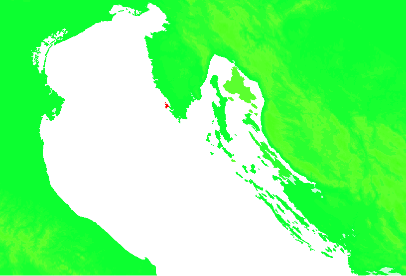
Position of Brijuni

The Brijuni or the Brijuni Islands are a group of fourteen small islands in the Croatian part of the northern Adriatic Sea, separated from the west coast of the Istrian peninsula by the narrow Fažana Strait. The largest island, Veliki Brijun Island- Brioni Grande or Veli Brijun (5.6 km2), lies 2 km off the coast, the others are Mali Brijun, San Marco, Gaz, Okrugljak, Supin, Supinič, Galija, Grunj, Krasnica (Vanga), Madona, Vrsar, Jerolim and Kozada. Famous for their scenic beauty, the islands are a holiday resort and a Croatian National Park.

History
The Brijuni Islands had some Ancient Roman settlements, but up to the late 19th century the islands were mainly used for their quarries, which have been worked on for centuries. The islands belonged to Venice from the Middle Ages, and stone from the islands was used to build the palaces and bridges of the city. The islands were part of the Illyrian Provinces after Napoleon's brief annexation.

In 1815 the islands became part of the Austrian Empire, which later became Austria-Hungary. During this period the islands' quarries first supplied stone to Vienna and Berlin. With the erection of a naval base in the harbour of Pula, the Austrians built a strong fortress on Veliki Brijun Island Island, together with minor fortifications on some of the others.

The Austro-Hungarian Navy abandoned the fortress, and in 1893 the Viennese business magnate Paul Kupelwieser bought the whole archipelago and created an exclusive beach resort. The estate was supplemented with first class hotels, restaurants, beach resorts, a casino and a yacht harbour and became a focal point in social life on the Austrian Riviera. Kupelwieser also established a sailing regatta, a golf course and - due to the flourish of Austrian Culture - various music concert and literature events. The Brijuni islands became popular as a destination for the Viennese upper class and were visited by members of the Imperial family and other wealthy European bourgeois and aristocrats.

In 1918 after World War I Brijuni became part of Italy. Karl Kupelwieser, the son of the founder of the estate tried to maintain the former splendor, but after the economic crisis following the Wall Street Crash of 1929, the estate went bankrupt and Karl committed suicide. In 1930 the islands were acquired by the Italian state and remained part of Italy until the capitulation in 1943.


The Safari Park

In 1945 after World War II the Brijuni became part of Yugoslavia and President Marshal Josip Broz Tito made the Brijuni Islands his personal State Summer Residence. Slovenian architect Jože Plečnik designed a pavilion for Tito. Almost 100 foreign heads of state visited Tito on his islands, along with film stars including Elizabeth Taylor, Richard Burton, Sophia Loren, Carlo Ponti, and Gina Lollobrigida. Tito died in 1980, and by 1983 the islands were declared a National Park of Yugoslavia.

In 1991 Croatia gained independence and made the Brijuni Islands an International Conference Center (see Brijuni Agreement). Four hotels on Veliki Brijun Island were re-opened, as well as a Safari Park, which holds animals given to Tito, such as Sony and Lanka, two Indian elephants donated by Indira Gandhi. Sony, who was donated to Tito in 1970 as a two-year-old calf, died in 2010. The International Brijuni Polo Tournament, dating back to Karl Kupelwieser's Austro-Italian Brijuni in 1924, has been re-continued since 2004.

Flora

1700 year old Olive tree

The majority of the flora on the archipelago of the Brijuni islands has the typical Mediterranean characteristics. On Veliki Brijun Island there are about 600 indigenous plant species. Here cedars, bamboos, and the pyramidal yew have become acclimatised, while on Vanga the dwarf spruce grows. There is also much exotic vegetation that Tito received from foreign statesmen. The most important plant associations of Veliki Brijun Island are: Maquis shrubland, Holm Oak, and Laurel forest, and Conifers, which are very characteristic of the region.

It is interesting to point out that on the islands there are some plant species that are among the endangered plant species of Istria (marine poppy, wild cucumber, some grass species etc.), but on the islands they are quite widespread and develop freely. The most valuable part of the island from the point of view of vegetation streches from the Villa Brijunka in the south, and the most lovely forest is found in the east of the White Villa.

Fauna

Birds

Because of the millennial presence of men on the archipelago of Brijuni, the animal world on the islands, especially Veliki Brijun, besides the autochthonous species, was enriched by many imported species that are not congenial to this habitat but got acclimated to it thanks to the almost ideal microclimatic conditions. Inside the park there is an ethno park is an area within the Safari park presenting a typical Istrian homestead with its autochthonous animal species. Istrian ox (a descendent of the Aurochs), Istrian sheep, donkeys and goats. It is intended both as a habitat and presentation of domestic animals of Istria.

In addition, the chital deer, the Fallow deer and mouflons were introduced to the Veliki Brijun Island in the early 20th century. Their numbers increased in the following decades and can be seen roaming freely around the island.

In the late 19th century and early 20th century the European Hare, the Chital, the Fallow Deer and the Mouflon were imported, so their descendants still adorn the forests, parks and glades of Brijuni and are part of its identity. The autochthonous birds are quite well represented. Some of the smaller islands are excellent habitats where gulls and sea swallows nest, as well as some rare genuses of Cormorants. The Brionian islands are also important seasonal habitats of northern bird species and the most interesting is the locality of Saline. That is a very damp area with three marshy lakes of 8 acres (32,000 m2) of fenced area with the aim of forming an Ornithology reservation. The biggest lake is overgrown with reed and is a good nestling ground for numerous types of birds.

On the island there is also a Safari Park, it is home to a variety of exotic animals which were given to the park as gifts from diplomatic partners. The Nilgai, Zebu and Asian Elephant were donated as a gift from India, Plains Zebra and Mountain Zebra were given by Ahmed Sékou Touré from Guinea, Waterbuck came from Ethiopia.

The local seas of the Brijuni archipelago are important hatching grounds and representative Marine Parks for the typical marine organisms of the northern Adriatic. Of the marine organisms that are protected by the Law on Environmental Conservation in the waters of Brijuni you can find the pen-shell and the date-shell. Turtles and dolphins, the protected marine vertebrates, can also from time to time be seen in the waters of Brijuni. There are also some endemic species like the black tang, Jadranski bračić, and the Tunicate, Jadranski ciganin.

The seabed abounds in sponges, shellfish, sea urchins, crustaceans, fish etc. In the past in the seas of Brijuni were found some species that were never seen in the Adriatic, as well as some species up to then unknown to scientists like the soft coral Alcyonium brionense or the variety of the sponge Ircinia variabilis fistulata.

Tourism
On the Brijuni there are several archaeological and cultural sites. At four sites on Veliki Brijun Island over 200 dinosaur footprints have been discovered, which can be traced to the Cretaceous Period from where Brijuni Cretaceous Park gets its name.

There are also several archeological sites worth seeing. There is the 13th century AD St. Mary's Church which was built by the Knights Templar. There are also two ancient Roman villa remains, from the 2nd Century BC and remains of a Byzantine palace. The last remain is Hill-fort which indicates a Bronze Age settlement on the island dating back to 14th century BC.

There are also several exhibitions including natural history and art exhibitions, and archaeological collections.

petak, 7. siječnja 2011.

National Park Paklenica


Paklenica interior

The Paklenica karst river canyon is a national park in Croatia. It is located in Starigrad, northern Dalmatia, at the southern slopes of Velebit mountain, not far from Zadar. It has two canyons: Mala (Small) and Velika (Big) Paklenica. Today there is no water flowing throughout Mala Paklenica. Near the entrance into the Velika Paklenica there is an artificial basement/cave complex that had been built for Josip Broz Tito during the tension between Yugoslavia and the USSR in the late 1940s and early 1950s.

Geological Features
he most attractive and most valuable parts of South Velebit are surely the impressive canyons of Velika Paklenica and Mala Paklenica. Velika Paklenica canyon is 14 km long and 500–800 m wide. In its narrowest part around the Bunkers, the canyon is only 50 m wide. Vertical cliffs rise above both sides of the canyon up to a height of over 700 m. The most attractive part is the area around the steep drop of the stream downstream from Anića luka, where steep cliffs rise directly above the stream, forming the narrowest part of the canyon between Anića luka and the parking lot. Mala Paklenica Canyon is of lesser dimension, and the torrent running through it is much less powerful. It is 12 km long and 400-500 wide. In its narrowest part, it is only 10 m wide, while the surrounding cliffs rise up to a height of 650 m.

The central part of the Park is distinctive for the relief complex of Borovnik and Crni vrh, with the valley of Mala Močila and Velika Močila nearby. In terms of relief, Velika Močila is a very interesting bowl-shaped valley at an altitude 850 m asl, surrounded by Crni vrh (1 110 m asl), Škiljina kosa (1 015 m asl) and Zeleni brig (842 m asl), while Borovnik, named after the black pine forest, stretches along the south edge.

The east part of the Park is very differentiated geomorphologically, inaccessible and wild. Further to the east, this zone of wilderness transforms into an area of milder forms around Malo Libinje and Veliko Libinje, karstic plateaus with numerous pits, the bottoms of which were mostly treated.

The highest area of Paklenica National Park is the narrow ridge of Velebit, 1 to 3 km wide. The highest peak of Velebit – Vaganski vrh (1 757 m asl) is also here. The area of Paklenica National Park is one of the most completely explored areas in Croatia in terms of speleology. 76 speleological objects are known and have been explored in the Park, namely 39 pits and 37 caves. We will mention some of the most interesting speleological objects in the National Park. Vodarica Pit is the longest cave in Velebit at 300 meters, Precipice on Bunovac (534 m) is the deepest object in Central and South Velebit.

Watertight sediments are situated beneath very porous karstic deposits of carbonate rock in the extended part of Velika paklenica, Brezimenjača, and in the spring parts of Mala paklenica and the occasional flow of Orljača. This is why Paklenica National Park has several permanent or occasional flows and many permanent springs. The permanent springs of high-quality drinking water are Stražbenica, Kontinovo vrilo, Crno vrilo, Velika Močila and Pećica.

Flora
The wealth of flora is reflected in the list of 1,000 plant species and subspecies recorded to date, 79 of them endemic. The great diversity, the presence of relict, endemic, rare, statutorily protected species make the Park a very valuable floristic area, not just in Croatia, but in Europe and the world as well.

The forest phenomenon is one of the main reasons why the South Velebit area was proclaimed a national park. Areas of oak and oriental hornbeam forests, beech forest, black pine forests, and fern forest, can all be found in the park.

Fauna
The diverse habitats in Paklenica and the vertical stratification provide home to a diverse fauna. Invertebrates are relatively poorly explored, attractive insects like diurnal butterflies are well explored. Over 40 species of amphibians and reptiles are found, the endangered Orsini's Viper is a highlight.

Birds are the most numerous group of vertebrates, with 230 species recorded to date. The world of birds is represented by 102 species of nesting birds found in the broader park area. The nesting bird group includes a community of birds inhabiting rocks and cliffs in the canyons of Velika Paklenica and Mala Paklenica, with 24 bird species. A special value is added to the park by the endangered and rare bird species such as the golden eagle, peregrine falcon , short-toed eagle and goshawk[disambiguation needed]. Forest areas are rich with woodpeckers, the rarest among them being the white-backed woodpecker and middle spotted woodpecker.

There are also 53 species of mammals at the park, the roe deer and chamois are highlights, while the brown bear is the biggest predator. In the caves there is a host of interesting underground animals such as crabs, mites, Nematodes, aquatic worms, spiders, pseudoscorpion, beetles and bats.

Touristic Activities
Hiking is the only way to really get to know Paklenica. The Park area contains 150–200 km of trails and paths, from those intended for tourists, leading from Velika Paklenica Canyon to Manita peć cave, Lugarnica forest cottage and the mountain hut, to those intended for mountaineers, leading to the highest peaks of Velebit. The trails in the Park are marked with boards and mountaineering signs.
Anica kuk (712 m / 2350 ft) is a home to the most well-known routes of Paklenica climbing area

Paklenica National Park is the most visited climbing site in Croatia, and the largest in Southeast Europe. The close proximity of seawater gives this climbing site a special charm, making Paklenica Riviera an ideal place to combine climbing and water sports. Today, there are over 360 equipped and improved routes of various difficulty levels and lengths within Paklenica’s climbing sites, so each climber can find to their liking. The main climbing season begins in spring and goes on until late autumn.

nedjelja, 2. siječnja 2011.

Kopački Rit


Kopački Rit (Kopački Tršćak, Hungarian: Kopácsi rét), is a nature park in eastern Croatia. It is located northwest of the confluence of the Drava and the Danube, situated at the border with Serbia. It comprises many backwaters and ponds along the Danube. It is one of the most important, largest and most attractive preserved intact wetlands in Europe.

The vicinity of the big city of Osijek and its surroundings, as well as excellent communications (by road, railway, plane and ship) enable a high visiting rate. The beauty of "intact" nature, the multitude of waters, flora and fauna attract not only excursionists and visitors but also many experts and scientists from the whole of Europe.

A part of Kopački Rit has been designated as a special zoological reserve. Around 260 various bird species nest here (wild geese and ducks, Great White Egret, White Stork, Black Stork, White-tailed Eagle, crows, coots, gulls, terns, kingfishers, Green Woodpecker, etc.), and there are many other species using this area as a temporary shelter on migration from the northern, cooler regions to the southern, warmer areas and vice versa.

There are 40-odd fish species (pike, ide, tench, bream, carp, catfish, pike-perch, perch, etc.). Several various mammal species inhabit the land (red deer, roe deer, wild boar, wild cat, pine marten, stone marten, weasel, sable, otter, etc.). Rich plant life, typical of wetlands, is found also in Kopački Rit.

Guided tourist visits by panoramic ships, boats, team of horses or on foot are available. Some packages offer the possibility of photographing or video-recording animals, birds in particular.

Angling and hunting are allowed in certain parts of Kopački Rit, which are put under less strict protection.

The specialities of Kopački Rit (fish stew, grilled carp, venison, Belje wines, etc.) can be tasted in the nearby restaurant.

subota, 1. siječnja 2011.

Plitvice Lakes National Park


The Plitvice Lakes (Croatian: Plitvička jezera) is a national park in Croatia in the Plitvice Lakes municipality, in the mountainous region of Lika.

Plitvice Lakes National Park lies in the Plitvice plateau which is surrounded by three mountains part of the Dinaric Alps: Plješevica mountain (Gornja Plješevica peak 1,640 m), Mala Kapela mountain (Seliški Vrh peak at 1,280 m), and Medveđak (884 m).

The national Park is underlain by karstic rock, mainly dolomite and limestone with associated lakes and caves, this has given rise to the most distinctive feature of the lakes.

Lakes

The lakes are separated by natural dams of travertine, which is deposited by the action of moss, algae, and bacteria. The encrusted plants and bacteria accumulate on top of each other, forming travertine barriers which grow at the rate of about 1 cm per year.

The sixteen lakes are separated into an upper and lower cluster formed by runoff from the mountains, descending from an altitude of 636 to 503 m (2,087 to 1,650 ft) over a distance of some eight km, aligned in a south-north direction. The lakes collectively cover an area of about two km², with the water exiting from the lowest lake to form the Korana River.

The lakes are renowned for their distinctive colours, ranging from azure to green, grey or blue. The colors change constantly depending on the quantity of minerals or organisms in the water and the angle of sunlight.

The lakes are divided into the 12 Upper Lakes (Gornja jezera) and the four Lower Lakes (Donja jezera).

You can read much more about Plitvice Lakes on Wikipedia.